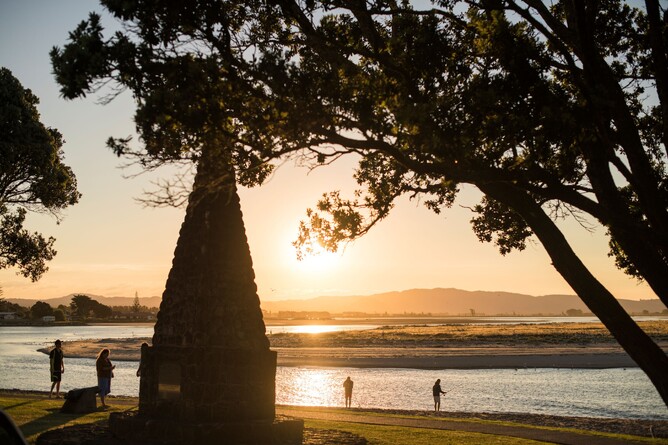
Photo: Te Arawa Monument, Maketū along Beach Road aside the Kaituna/Ōngātoro Estuary at Maketū, was built for New Zealand’s 1940 centennial celebrations of the signing of the Treaty of Waitangi. It marks the landing point of the Te Arawa canoe after its journey of over 3,000km from Hawaiki.
A new resource to be released during the first half of 2025 is currently in development towards discovering the many historical heritage sites across the Western Bay of Plenty which connect them to their communities.
Taonga Tū Heritage Bay of Plenty, working with Heritage New Zealand Pouhere Taonga (HNZPT), local hapū and iwi, Western Bay of Plenty District Council’s Community Archives and history groups across the rohe, are developing a second Footprints Series to cover the Western Bay of Plenty. The second series will follow Ngā Tapuwae ki Te Papa | Footprints on Te Papa, developed in 2022, which showcases 72 historic locations from Fifth Avenue to Sulphur Point, Tauranga.
The heritage of the Western Bay of Plenty will always be a partnership between hapū, iwi, and pākehā. This heritage map, guide and website aims to be a supportive and valuable resource for each community, for teachers, other Heritage linked programmes and the tourism sector. This resource is not just about highlighting our heritage sites, it is about connecting the heritage across the rohe to each other, to our differing communities and for our visitors.
As the second in the series, it also assists to broaden the community's resources as we learn more about the elements of Western Bay of Plenty’s cultural, built and natural heritage.
Bruce Farthing, Chair of Taonga Tū Heritage Bay of Plenty, says it is essential to continue discovering and sharing historical heritage information at a glance, and in an easily digestible format at grassroots level within each community.
“We know that forming a deeper understanding of our history and our landscape through learning more about our history, brings a greater sense of identity and belonging”. says Farthing, “In turn this grows pride and respect not only for the community we live in day to day but for the wider region and in turn for Aotearoa New Zealand”.
Much of the information included in the map is already available through regulatory authorities such as Heritage New Zealand Pouhere Taonga, the Department of Conservation Te Papa Atawhai (DoC), our three Councils other sites. However, these formats are fragmented, difficult to find and not easily accessible to teachers or tour operators. Additionally, this knowledge is not fully understood by our locals, or placed in our classrooms nor utilised fully when visiting the area. This new tool will also be encourageing Māori to share their own heritage and perspectives in their own way to the sites that are special to their people.
The format of the Footprint Series allows people, at their own leisure, either walking, cycling or driving, to go on a self-guided tour to explore the heritage sites of the Western Bay’s history which is forever connected to our landscape and to our people. It will also encourage – through links and other references - teachers, tour operators and others to explore site information further and to consider field trips for students or visitors.
Binnie Brown, Trustee of Taonga Tū Heritage Bay of Plenty, says most people have very little awareness of the depth of Western Bay’s history and its relationships to our landscape .
“After the success of Ngā Tapuwae ki Te Papa | Footprints on Te Papa, it is time to start exploring our Western Bay of Plenty’s heritage,” says Brown, “This project is about in situ heritage at grassroots level and respecting and protecting each rohe’s heritage independence and storytelling.”
Although there are more than 6,000 documented heritage sites across the Western Bay of Plenty, most of our locals, schools, and visitors do not know about them. The Footprints Series highlights some of these recorded sites in the hope of encouraging many to start exploring the heritage journey for themselves.
Ben Pick, Lower Northern Area Manager of HNZPT, says these maps will help people to start identifying heritage sites of significance that surround them, to start asking questions, and to begin discovering the treasure trove of historic heritage information that connects us across the Western Bay through Heritage New Zealand Pouhere Taonga, libraries, archives, historical societies, history groups, heritage organisations, museums, genealogists archeologists and online resources.
“Often the historic heritage sector is all too confused with and placed within the arts and culture sector, but they aren’t the same,” says Pick, “Historic heritage relates to a society’s physical and intangible cultural beliefs, monuments, buildings, tikanga and other sacred traditions that live on via continuous cycles of storytelling and taonga.”
Sandra Haigh, Community Heritage Services Co-ordinator|Kaiwhakarite Ratonga Tikanga Hapori for Western Bay of Plenty District Council, is keen to encourage the community and visitors from near and far discover the richness and depth that lies in the stories of the Western Bay of Plenty’s smaller communities.
“this map acts as a gateway to a world of korero which seem to come from another world and another time, but remain integral to who we are and how we live right now in Aotearoa. It’s just the beginning to discovering stories of people who made New Zealand what it is. By understanding our past, we improve the way we move forward into the future.”
The development of this project was supported by $65,000 in funding from TECT.
TECT Trustee Peter Farmer says, “It is great to see these maps encouraging people to take notice and learn about the places and moments that have shaped our region.”
“The work Toanga Tū Heritage Bay of Plenty is doing complements the work of the new Te Tai Whanake ki Tauranga Moana Local Curriculum for our younger generation and will ensure that stories and knowledge are not lost, as these resources will be made readily available.”
Once complete, the sites to be discovered in the Historic Western Bay of Plenty Footprints map, guide and website will be promoted through Bay of Plenty schools, libraries, i-sites, other publications and through social media.
It will be a great tool to start the discovery of our Western Bay heritage. It will also be distributed farther afield across the Bay of Plenty to encourage more people to visit the rohe.
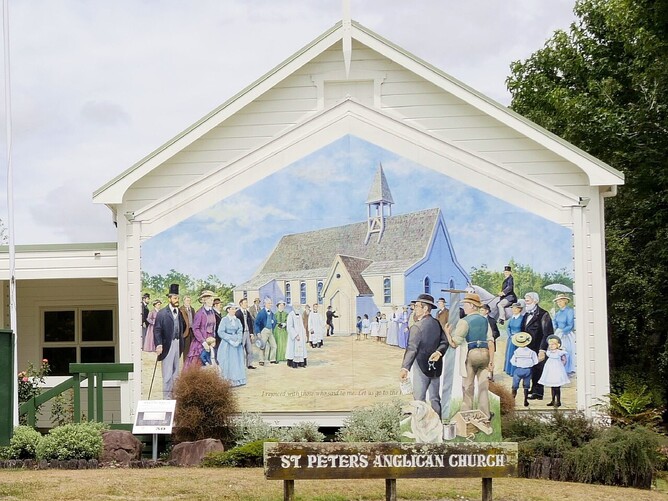
Photo: St Peter’s Anglican Church, Katikati is Historic Place Category 2 Listed with Heritage New Zealand Pouhere Taonga. It was first consecrated on 15 October 1883, but owing to fiscal nuances, its first service was 11 May 1884. All are welcome to visit.


